The wildfires that recently swept through the North Bay left behind ruined homes and charred landscapes, and researchers are now studying those fires to better understand how and why they burned the way they did.
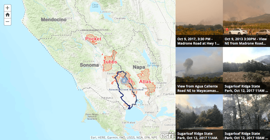
To support this effort, Sonoma Ecology Center announces North Bay Fire Images, a citizen science platform that allows anyone to upload photos taken during the fires into a single database. Using geographic information systems (GIS) technology, this database, developed by Sonoma Ecology Center’s GIS Manager, Alex Young, creates a “story map” online, allowing researchers and the general public to sort and view the thousands of images captured throughout the North Bay during the fires.
The crowd-sourced data — covering the North Bay between Oct. 8 and Oct. 30 of last year — will help scientific researchers and the general public grasp the devastating effects of the Nuns, Tubbs and Atlas fires.
“We all want to know what burned and what didn’t, and why. How did the weather, the buildings, and the vegetation interact, during the course of the fires, to create the event we all just experienced,” said Sonoma Ecology Center Executive Director Richard Dale. “Now, with the public’s help, we can map the many images recorded in real-time during those fires. This will help us understand what happened, and how to prepare for it in the future.”
All members of the public with images taken during the North Bay wildfires between Oct. 8 and Oct. 30 are encouraged to upload them to North Bay Fire Images by going to www.northbayfire.org. Uploading the images is fast, easy and secure.