Sonoma Ecology Center Executive Director Richard Dale and his family are enjoying a road trip to British Columbia – and they’re making the drive in their all-electric Chevrolet Bolt EV. What follows is Richard’s chronicle of the highs and lows of taking the so-called Electric Highway – a network of EV charging stations along the West Coast – from Sonoma to British Columbia.
By Richard Dale
This is a not-so-careful account of our journey into the unknown world of long distance electric vehicle travel, from Sonoma, California, to Ganges Harbor on Salt Spring Island, BC, Canada. It is the result of a family conversation about how to travel with a lower carbon footprint and still maximize things that we like to do on our vacations: see beautiful places, especially natural ones; hike, swim, backpack, bike, run, and lounge in these places; learn more about the interconnected processes and organisms of earth; visit people and interesting cultural places that stimulate interesting conversations; and eat good food, preferably lower on the food chain, especially wild berries. That suggests a long ride in an EV, doesn’t it?
Day 1. June 29, 2018 – Sonoma to Ashland
With lots of planning, probably not enough, we began our first day by loading up our leased Chevy Bolt, which surprisingly held everything we had planned to bring with some room to spare. Admittedly, we took a lot less than we might have in an “ICE car” (short for an internal combustion engine vehicle – a term you’ll hear electric vehicle drivers use somewhat disparagingly; once you’ve driven an EV, it’s really hard to go back). We had found some disappointing information about the extra drag on vehicles using roof racks, EVs especially, so we pared down our travel gear to typical travel clothing, some recreational equipment including backpacking and water gear, and a few light accessories. The extra room was a bonus we hadn’t expected.
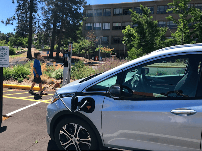
We left Sonoma at 9 a.m. in light traffic, planning to reach Ashland that day, and travelled about 35 miles to our first stop in Vacaville. The Vacaville Premium Outlet Mall, more specifically. There was an impressive lineup of Tesla charging stations out front gleaming in the morning sun, and way in the back of this sprawling complex, near the security station, was one lonely EVgo fast charger with two connections for most other vehicles – CHAdeMO for the Nissan Leaf, and CCS, the standard, for all others – like you might find at a Whole Foods in the Bay Area, along with a Level 2 charger, the kind most people install at home (and available now to Sonoma Clean Power customers free of charge).
There was no wait, we plugged in with little effort, flashed the card at the charger that came with the car and that we’d linked to a credit card, and it started right up. We learned in advance that there were a limited number of these higher wattage, 50 kilowatt per hour (kWh or kw) chargers on our route, and this was the last one for about 170 miles. Our Bolt has a 240-mile average range, and having never taken such a long trip before, it seemed like we should play it safe and top up until we were confident about how to calculate the range. This turned out to be a very good move.
Pulling out of the station about half an hour later (26 minutes, 6.7kw charge; EVs charge more slowly as they get close to a full charge), we headed onto I-505 toward I-5 with the distance calculator pledging a confident 240-mile, middle range estimate, based on past driving. About 70 miles later, with 90 miles to go to our next planned stop, we realized that travelling at freeway speeds on rural interstates (70-80 mph) was really sapping the battery juice. There was also a headwind and it was 95 degrees so we had the AC on, factors that also increase power use. In one hour, we had used nearly half of our charge. This caused some panic and fast recalculations about range and whether and where to stop next. Unfortunately, with only a couple of “half-fast” chargers (24 kw/hr, or 65-70 miles added per hour) ahead, the prospect of waiting for long periods in the heat in remote Central Valley parking lots now loomed depressingly large. We wondered if we should turn back and rent an ICE vehicle.
Instead, we changed tactics. Rather than whizzing by the slow traffic with the pack leaders, we dropped in behind vehicles travelling 55 to 60 mph, stayed in the draft of large trucks or RVs, and only used the AC in short intervals. This all worked, and we made the next 90 miles with 20 miles to spare, and quite a lot of relief. It was a big lesson about power consumption and speed and wind resistance, and worth a note that the stretch between Redding and Vacaville requires some careful driving to make the distance.
Once we got to Redding, we found our next planned stop, a Target parking lot with a ChargePoint fast charger, a few miles off the highway. It was 96 degrees but the same wind we’d been fighting made it quite pleasant in the shade (and not so great for a wildfire that had broken out behind us). Again, there was no competition for that critical charger on a midday Friday in the middle of summer, and we connected right up. This charger’s display touted that it was part of the Electric Highway, and the app we downloaded showed our car charging at a good 50 kWh clip. We explored the suburban wilderness looking for lunch.
Two hours later the ChargePoint app showed that we’d fully recharged. The car’s display now showed a not so cocky 200-mile range. That was plenty to drive the 130 miles to Ashland, even with several thousand feet of climbing over the watershed divide near Mount Shasta City and the Siskiyou Mountains pass above Ashland. It wasn’t so cool that this charge cost us $25, half of which was a parking fee when there were empty spaces all around us. Ah well; it is one of the most expensive chargers on the route, and it was still less than most people pay for gas. We drove off at 3:15.
The drive got a lot more interesting as we left Redding and headed into the mountains. Interstate 5 crosses Shasta Lake several times, the largest reservoir in California’s elaborate water system, and it was nice to see that even with an average winter, the prior year’s large storms had left the lake about as high as we’d ever seen it, near the top of its bathtub rings. Two years earlier, the lake had been hard to find, more than 100 feet below its current level.
We threaded our way up into the mountains, and Mt. Shasta, the second tallest volcano in the Cascades at 14,179 feet, grew massive beside us. We stopped at two of our favorite spots, Lake Siskiyou, a reservoir a few miles off the highway with great swimming and mountain views, and a city park where the Sacramento River emerges from a lava tube on the side of the mountain. The water in that spring is clean, cold, refreshing, and has taken 50 years to filter down through the mountain from snowmelt high above.
Even with the stops that turned our trip from ordeal to vacation, we arrived in Ashland around 7 p.m., with 60 miles of charge showing. We’d been able to drive at normal speeds. We felt relieved and better now about our EV road trip.
Click here to read Traveling the Electric Highway: Part II