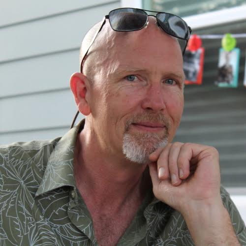
We sat down with Jack Hines, our GIS Specialist and Soundscape Specialist, to learn more about his work at Sonoma Ecology Center and his path to getting here.
Tell us about your path to Sonoma Ecology Center. What has led you to become our GIS Specialist and Soundscape Specialist?
I am three years into my second round of working with the Sonoma Ecology Center. My first round was in the late 1990s. At that time, they gave me my first real hands-on experience working with GIS (Geographic Information Systems) as a volunteer, which eventually led to my working with them as a part-time GIS Technician.
During that time I was fortunate to be introduced to Dr. Bernie Krause, a pioneer in the field of soundscape ecology. I’m a musician and also have a passion for nature and wilderness, so I was very drawn by the idea of recording the soundscapes of wild places. I went to work with Bernie’s company, Wild Sanctuary, Inc., in 2000, and have continued an association with them since then. So, Soundscape Specialist is another hat I wear at the SEC.
In 2004, I began teaching music to at-risk youth at Hanna Boys Center. However, after having nearly lost my home in the Nuns Fire of 2017, and witnessing my dear friends Bernie and Kat Krause losing theirs, I decided to reset my priorities in life and thus turned my attention back to ecology, soundscape ecology, and performing music. After a year and a half as a part-time GIS Technician with Napa County ITS Dept., I rejoined the Sonoma Ecology Center in June of 2020 as a GIS Specialist.

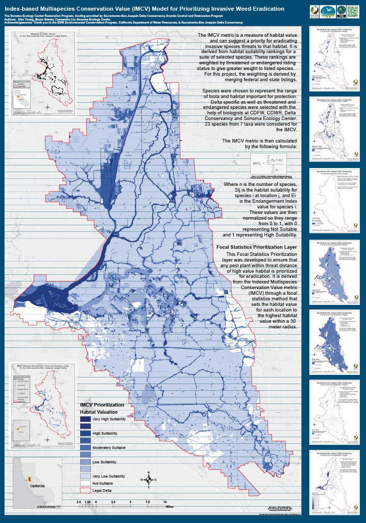
An example of a GIS mapping project we conducted. We mapped the highly invasive plant species Arundo donax throughout the Delta as part of a Sacramento/San Joaquin Delta Conservancy eradication effort.
What do you like the most about data mapping for our clients?
I think of maps in two basic ways. One is functional: maps that folks can put to use for whatever it is they need to accomplish. The other is aesthetic: those that are beautiful or interesting to look at, almost like a piece of art. In this sense, mapping offers the challenge of combining science and functionality with the artistic, and I enjoy that challenge. Sometimes I make interactive web maps for people, where they can zoom in/out, turn layers on/off, and explore the various attributes of the different features. Other times I might produce a PDF map to be included in a report — a map that can help tell the story of someone’s project. There are also times when a client wants a series of poster-sized maps that might include an overview map and a series of others that focus on certain areas.
Maps are fascinating, and can really draw people in and illuminate different perspectives of the landscape and how we relate to it. I enjoy the challenge of making all the layers and “moving parts” work together in a seamless manner.

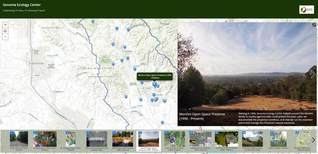
A screen capture of SEC’s Celebrating 25 Years, 25 Amazing Projects mapping.
What is a favorite project that you’ve worked on?
When I came back on board three years ago, I was tasked with figuring out a way to automate a workflow for an ongoing project that involves mapping the results of a bi-monthly monitoring effort. This was for a project with Sonoma Water and the Sonoma Valley Groundwater Sustainability Agency (GSA) and that measures how much water seeps into the ground along various reaches of Sonoma Creek. My Research Team colleague Wendy Hayes does the fieldwork to collect the data, and then processes it and sends it to me for mapping. Our deliverables include PDF maps as well as digital files of the spatial data. The challenge was to design the GIS workflow in such a way that multiple map layouts — one for every monitoring period (six per year) — could draw from the data and generate updated maps.
The outcome of this effort was a design that partially automates the process of populating the maps with line widths, colors, and numbers that indicate how the data compare to the previous sampling periods. In other words, whether there was a gain in flow, a loss, or if it remained neutral. It was gratifying to solve such a complex puzzle and to have it make the process of creating the maps every two months go so much more smoothly.
What do you wish community members knew about our data mapping services at SEC?
I would like community members to know that the SEC has a fully functioning “GIS shop” that is ready and available to help with whatever mapping needs they may have! The SEC GIS Program has been part of the organization since 1993. While we provide mapping support for various in-house projects and contracts, we’re also available to do so for private landowners and other organizations. Many organizations have an occasional need for mapping work, but not enough to warrant having a full-time GIS person on staff. Since we do have such a person (yours truly), we’re in a great position to be able to help others with those occasional mapping needs.
What are your hobbies and interests outside of work?
I have a degree in Music from San Francisco State University. Music is a big part of my life, and I earn part of my living as a bass player. I also sing, write, record, and play some guitar and piano. Here’s my music website. I play an instrument from the Baroque period as well, called the Viola da Gamba. I recently picked up a one-of-a-kind electric version of it, and am excited to begin playing that more. Here’s a video!
I play in several local bands. One is called Wolf Run, and has an album coming out soon. Another is called The Silverado Pickups. We released an album earlier this year, called “Bacon, Butter, and Salt,” which was recorded in Nashville last year. Watch for us at Bottlerock on May 27th!
Lastly, I have a website, called Ear to the Wild, for my soundscape recording work. This year, I started producing a weekly interstitial segment for KRCB 104.9 FM. You can check those out on the Ear to the Wild blog page, or by tuning in to 104.9 FM and listening for the short “Ear to the Wild” segments between their regular programming.
I also enjoy hiking, motorcycling, and the occasional adventure to explore new places, near and far. Often to record more soundscapes of course!
