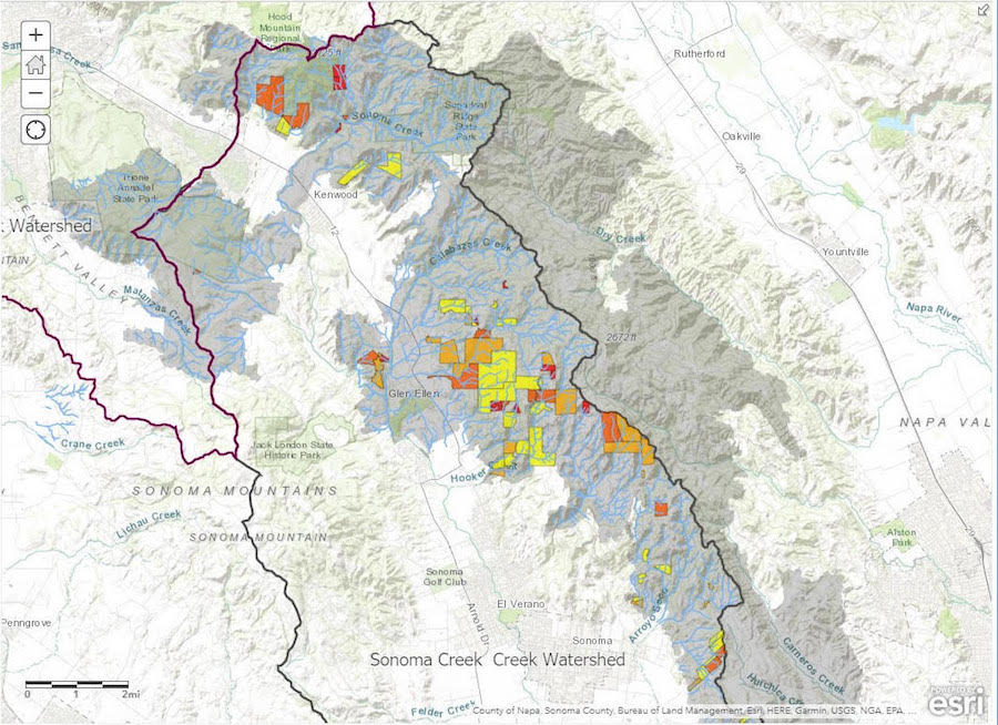
Our GIS Manager Alex Young has been working with the county’s Watershed Task Force in order to help identify post-fire erosion risk – which can remain high for several years after a wildfire – in Sonoma Valley and the county.
Alex has been performing “GIS landscape suitability analyses” to identify those sites that are most vulnerable to post-fire erosion. He also created a story map to showcase some of the post-fire erosion control work done around the Valley under the Watershed Task Force funding. The maps will be put to use during a countywide meeting next month.